web analytics

Category: Uncategorized

  • Amargosa

    Amargosa

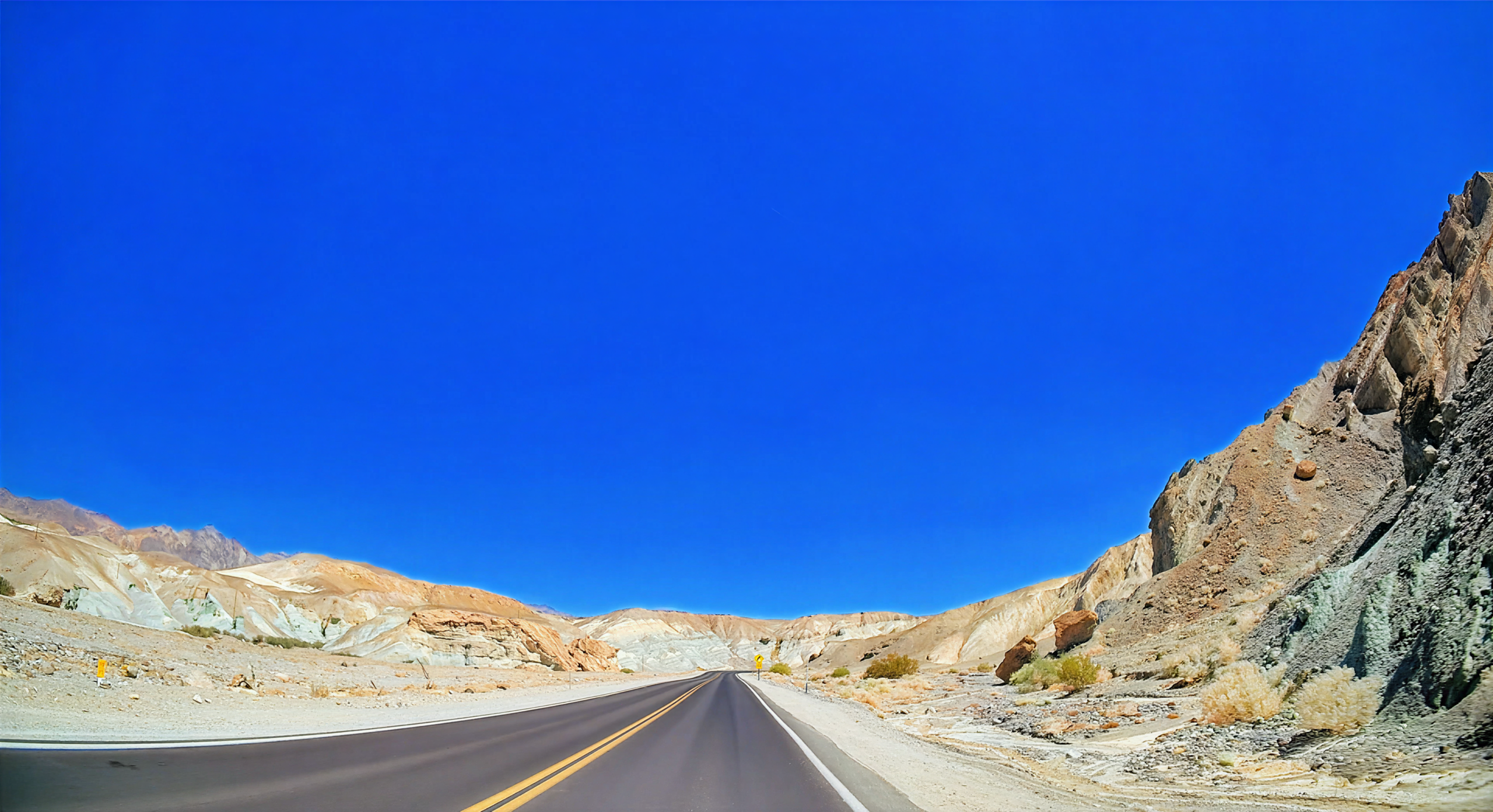
    The road climbs out of Death Valley like a ribbon of heat shimmering over jagged desert ridges, leading through the Amargosa Range and toward Las Vegas via Highway 160. In summer, the mountains glow in shades of red, gold, and brown, their rocky faces etched with centuries of erosion, while the occasional flash of silver from a distant dry creek catches the sun. The desert flora is resilient and sparse—creosote bushes twist against the wind, clusters of cacti bloom bright against the dry earth, and Joshua trees stretch into the blue sky.

    Sharp switchbacks reveal vast canyons below, with distant peaks fading into the shimmering heat waves. As the highway descends toward the Mojave lowlands, the terrain softens to rolling hills and open valleys, punctuated by abandoned mining camps and tiny desert settlements. The contrast between the raw, untamed mountains and the bright lights of Las Vegas emerging on the horizon is striking, and summer’s long days make every overlook, every ridge, and every wash along the road a chance to pause and absorb the desert’s scale and solitude.

    Captured in August 2025. Primary roads are California SR 190, State Line Road to the Nevada border, and Nevada SR 160 from Pahrump.


    Amargosa (1:31:03)

    Original music for this video:

    Loading map…
    Distance
    99.60 mi
    Elevation gain
    +6,438 ft
    Elevation loss
    −4,168 ft
    Max elevation
    5,514 ft
    Elevation profile


    Rear-Facing (1:24:58)

    YouTube playlists:

    Original ambient music available for streaming at:

  • Jasper

    Jasper

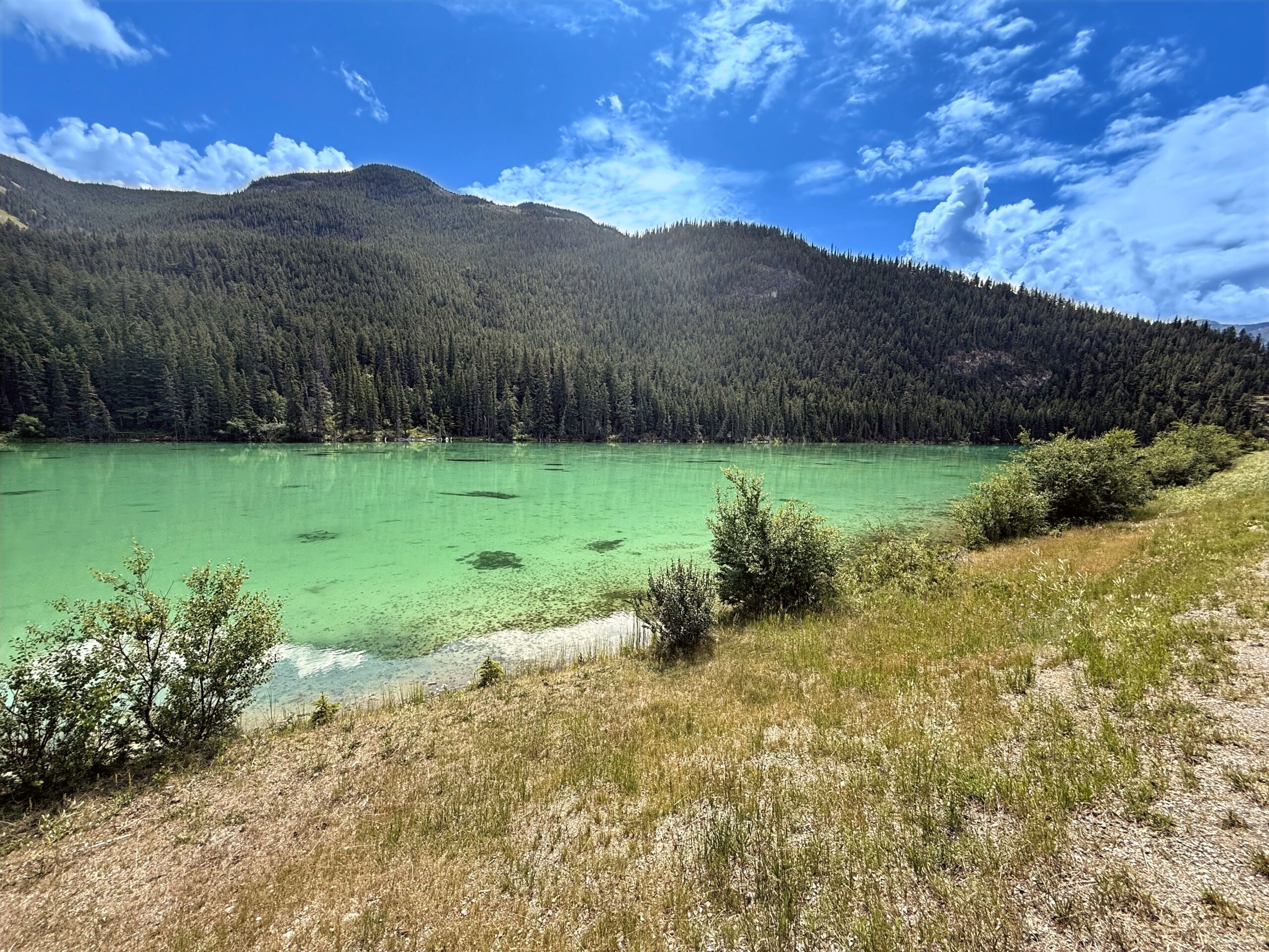
    Summer on the road from Jasper National Park to McBride feels like stepping into a living painting of mountains, rivers, and forests. The highway threads through jagged peaks mirrored in turquoise glacial lakes, while alpine meadows carpeted in wildflowers sway in the gentle mountain breeze. Moose and elk graze quietly in open valleys, and occasional bears forage along the forest edges, reminding travelers of the wilderness’s vibrant life.

    As the drive continues westward, the towering Rockies gradually soften into rolling forested hills and deep river valleys. Streams tumble down rocky slopes, waterfalls sparkle in the sunlight, and long summer days make it possible to stop at lakesides or scenic overlooks to take in the grandeur. By the time McBride appears, the combination of mountains, forests, and sparkling waters leaves a lasting impression of Canada’s untamed beauty.

    Captured in July 2025 along Canada Highway 16, also known as the Yellowhead Highway, from Jasper to McBride.


    Jasper (2:33:03)

    Original music for this video:

    Loading map…
    Distance
    146.54 mi
    Elevation gain
    +4,162 ft
    Elevation loss
    −5,282 ft
    Max elevation
    3,925 ft
    Elevation profile


    Photos (8:37)


    Rear-Facing (1:25:07)

    YouTube playlists:

    Original ambient music available for streaming at:

  • Grand Teton

    Grand Teton

    Traveling through Grand Teton National Park in summer feels like driving through a living postcard of the Rocky Mountains. The highway curves along glacial valleys, revealing soaring peaks and jagged ridgelines against bright blue skies. Alpine lakes reflect the mountains above, creating mirror-like scenes that change with every bend in the road, while wildflower-filled meadows carpet the valley in shades of yellow, purple, and red. Moose graze near marshes, bison wander through open fields, and eagles soar above, making wildlife a constant companion along the route. Streams and waterfalls rush through canyons, their cold water sparkling in the sun, while the surrounding forests provide shade and a cool respite from the summer heat. Scenic overlooks and quiet pullouts allow for moments of reflection, where the sheer scale of the Tetons and the vivid colors of summer create an immersive, unforgettable mountain journey.

    Captured in July 2024 from the south side of Yellowstone to Jackson, Wyoming.


    Grand Teton (51:14)

    Original music for this video:

    Loading map…
    Distance
    74.14 mi
    Elevation gain
    +0 ft
    Elevation loss
    −0 ft
    Max elevation
    0 ft


    Photos (7:38)


    Rear-Facing (1:02:19)

    YouTube playlists:

    Original ambient music available for streaming at:

  • Death Valley

    Death Valley

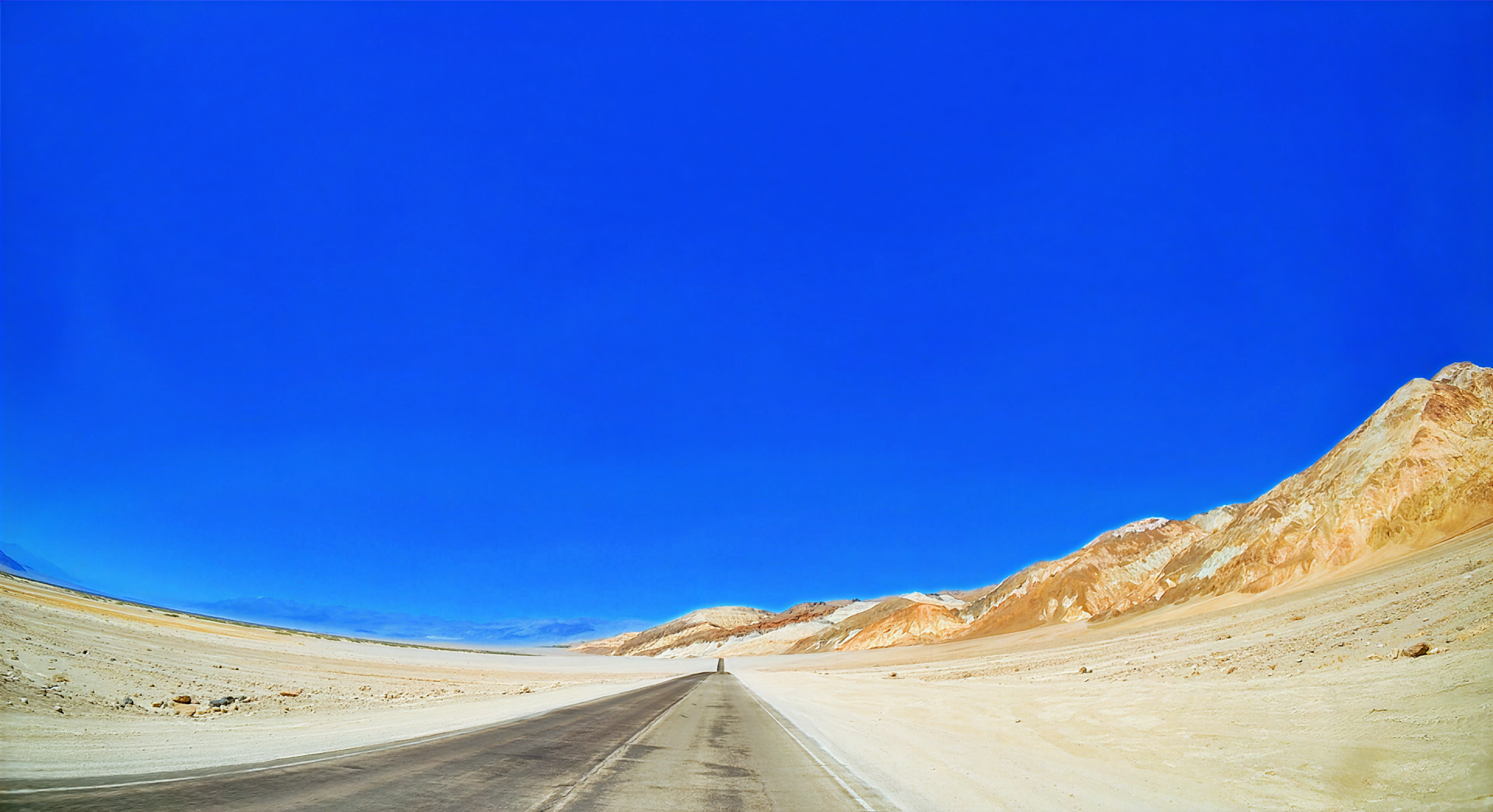
    A summer drive from Shoshone through Badwater Basin to Furnace Creek takes travelers through some of the most extreme and visually striking landscapes in the desert southwest. The route begins in sun-baked desert valleys dotted with hardy shrubs before opening to the stark, dazzling white salt flats of Badwater Basin, where the scale of the landscape feels almost otherworldly. The heat of summer intensifies the shimmering horizon, and distant mountains rise in jagged relief against the brilliant sky.

    Driving north, the road snakes through narrow valleys and past sand dunes, volcanic outcrops, and dry washes that reveal the geological diversity of Death Valley. The contrast between flat desert basins and towering ridges creates a dramatic rhythm to the journey, while the occasional sighting of bighorn sheep or desert birds reminds travelers that life persists in this extreme environment. By the time Furnace Creek appears, the combination of stark beauty, immense scale, and desert silence makes the drive feel like a true passage into another world.

    Captured in August 2025 along California SR 127 through Shoshone onto SR 178 toward Badwater up to Furnace Creek.


    Death Valley (2:18:30)

    Original music for this video:

    Loading map…
    Distance
    134.80 mi
    Elevation gain
    +6,391 ft
    Elevation loss
    −6,660 ft
    Max elevation
    3,269 ft
    Elevation profile


    Photos (9:49)


    Rear-Facing (2:16:52)

    YouTube playlists:

    Original ambient music available for streaming at:

  • Richardson Highway

    Richardson Highway

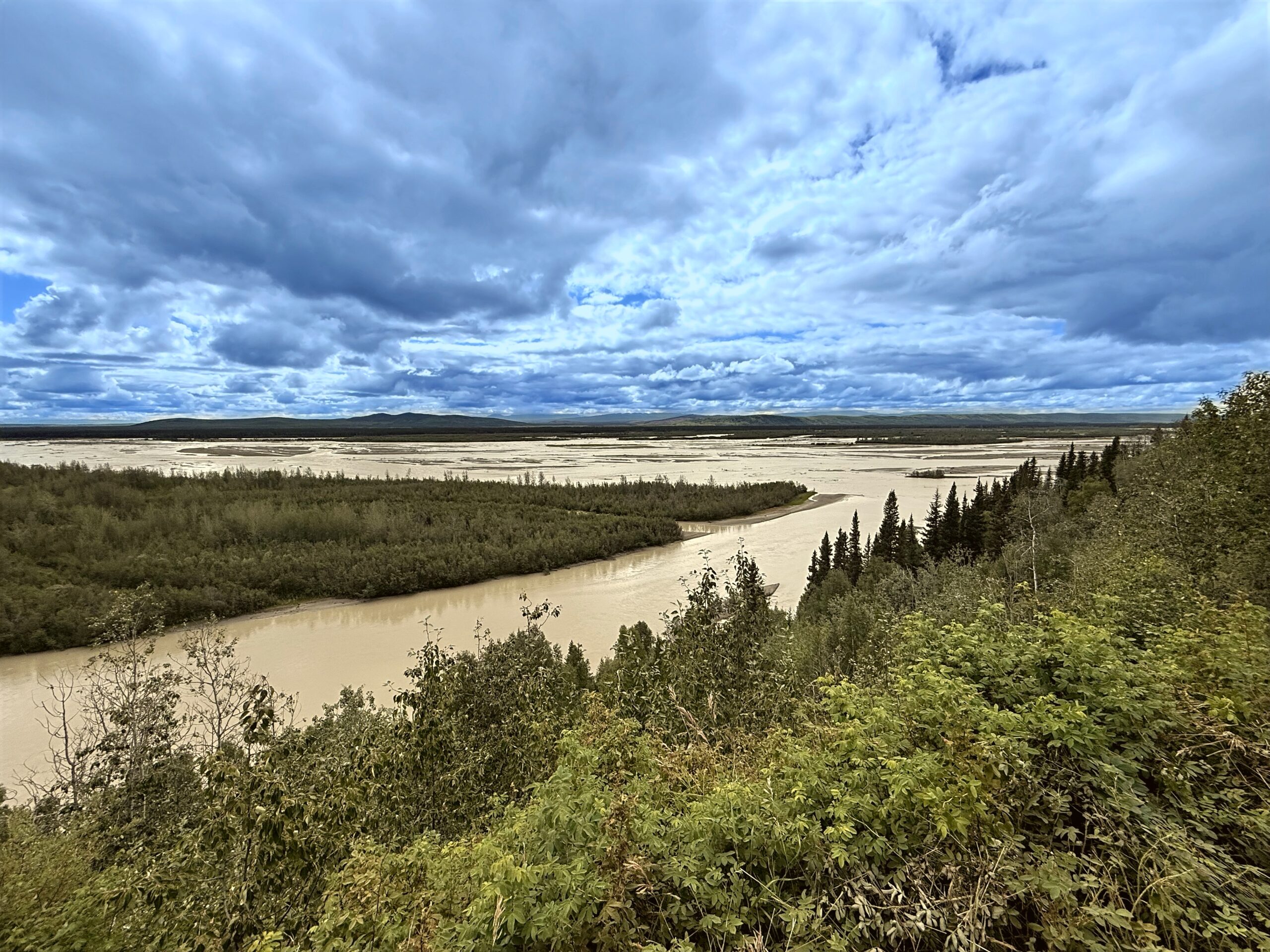
    The drive along Richardson Highway (AK-2) from Delta Junction through North Pole to Fairbanks in the summer showcases Alaska’s rugged interior in all its northern glory. The road stretches through a mix of boreal forests, wide-open tundra, and gently rolling hills, with rivers and small lakes glinting under the endless sun. Approaching North Pole, roadside signs and colorful displays of holiday cheer provide a whimsical contrast to the natural beauty that dominates the journey. Wildlife frequently appears along the route, with moose browsing near streams and eagles circling high above.

    The long summer days make it easy to pause at scenic viewpoints to take in expansive views of the Alaska Range and the broad valleys below. By the time Fairbanks is reached, the mixture of wilderness, playful small-town touches, and the shimmering rivers of interior Alaska combine to make this stretch of the Richardson Highway a memorable and immersive summer road trip.

    Captured in July 2025 along the Richardson Highway AK-2 segment from Delta Junction through North Pole to Fairbanks, Alaska.


    Richardson Highway (1:25:10)

    Original music for this video:

    Loading map…
    Distance
    99.93 mi
    Elevation gain
    +2,355 ft
    Elevation loss
    −3,103 ft
    Max elevation
    1,363 ft
    Elevation profile


    Photos (4:15)


    Rear-Facing (1:06:19)

    YouTube playlists:

    Original ambient music available for streaming at: