web analytics

Author: neckercube

  • Delta Junction

    Delta Junction

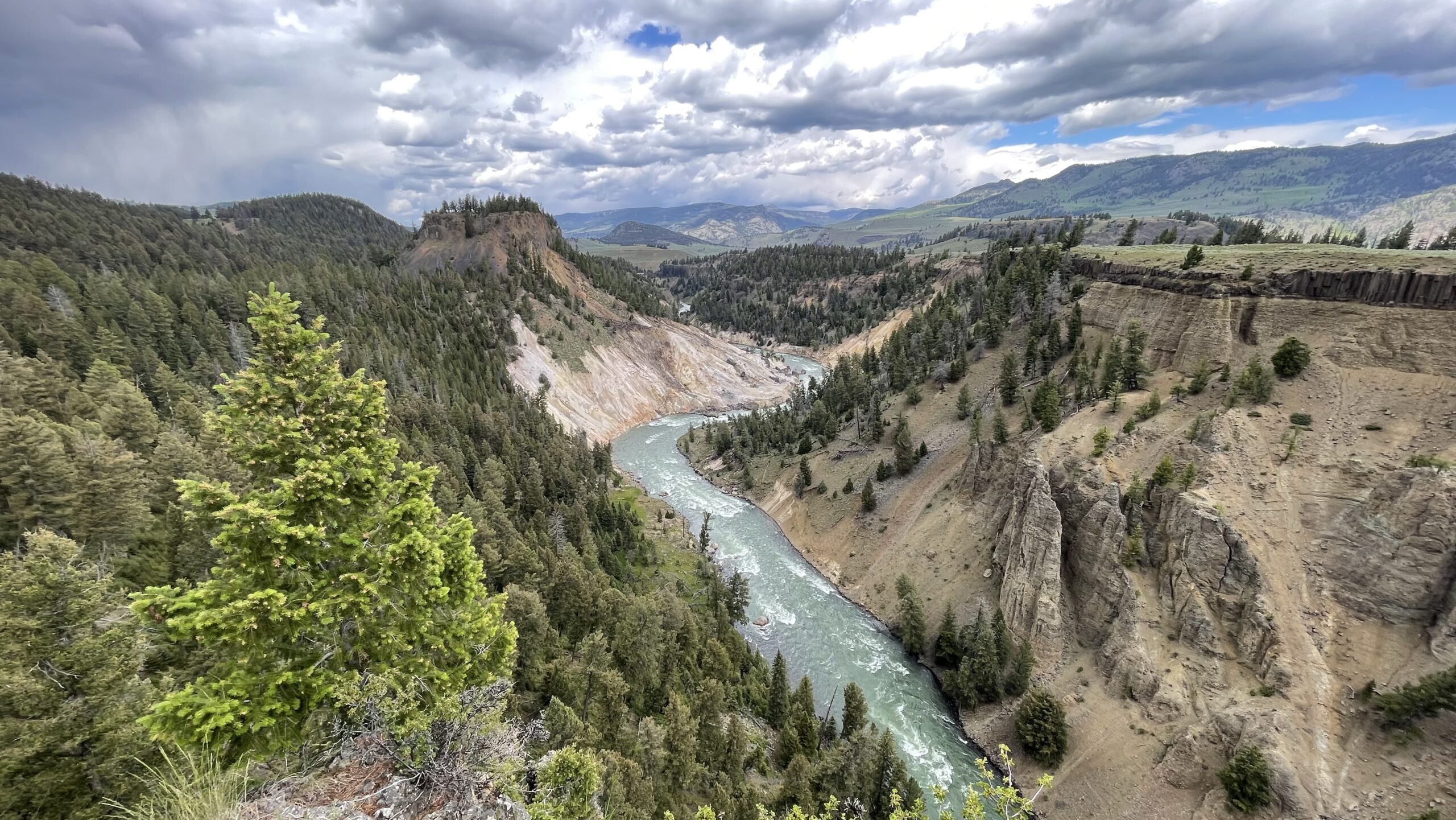
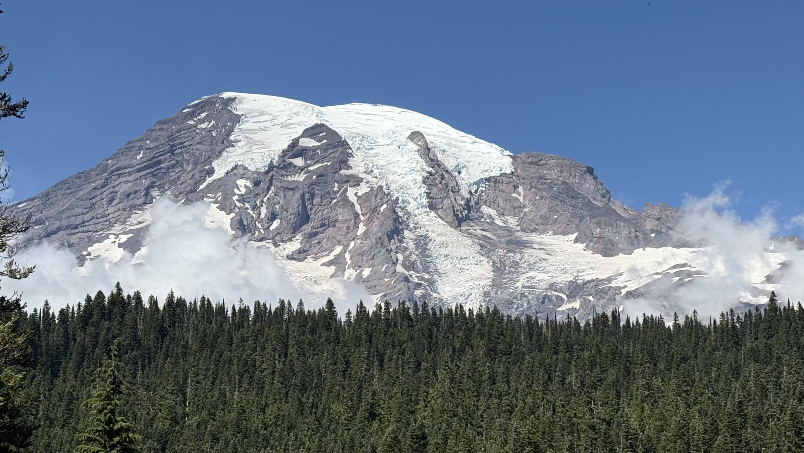
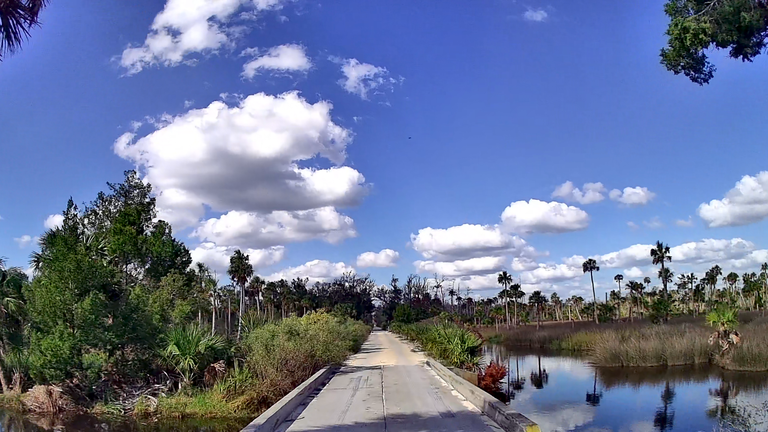
    Traveling the Alaska Highway from Tetlin Junction to Delta Junction during the summer brings a sense of true northern exploration. The highway cuts through wide stretches of boreal forest and open tundra, with the Alaska Range occasionally emerging in the distance through shifting clouds and clear blue skies. Lakes, marshes, and winding rivers shimmer beside the road, reflecting the pale northern light that lingers far into the evening during the height of summer. The air remains cool and fresh even on warm days, carrying the scent of spruce trees and damp earth through open windows.

    Traffic is sparse along much of the route, adding to the feeling of isolation and making the vast wilderness feel even more immense. Along the drive, roadside viewpoints reveal endless forests stretching toward distant mountains, while occasional wildlife sightings remind travelers how untamed the region remains. As the day slowly fades into a long northern twilight, the landscape takes on softer shades of blue and gold, giving the scenery a quiet and almost timeless beauty. The journey between Tetlin Junction and Delta Junction is less about reaching a destination and more about experiencing the scale, silence, and raw natural character of Alaska’s interior.

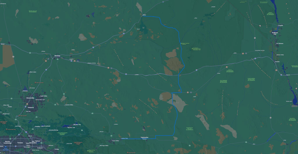
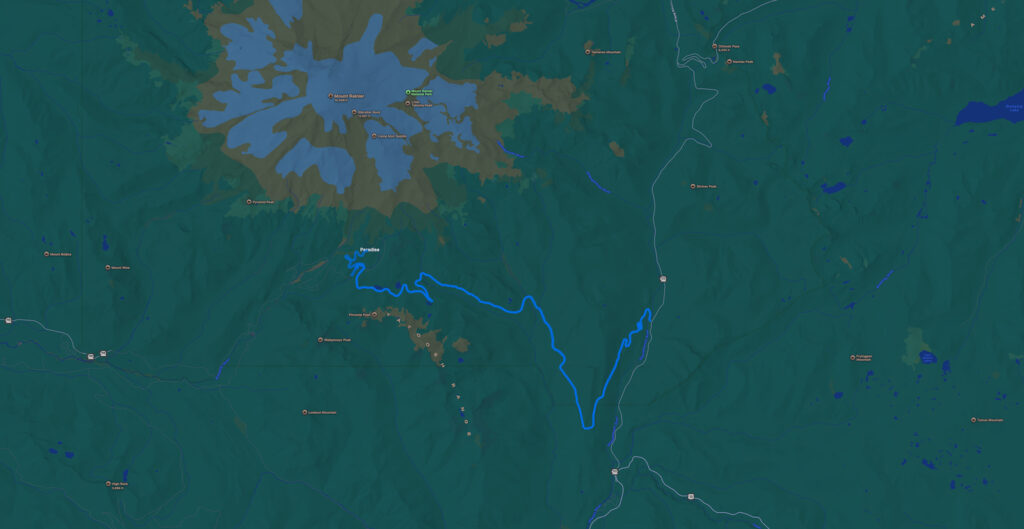
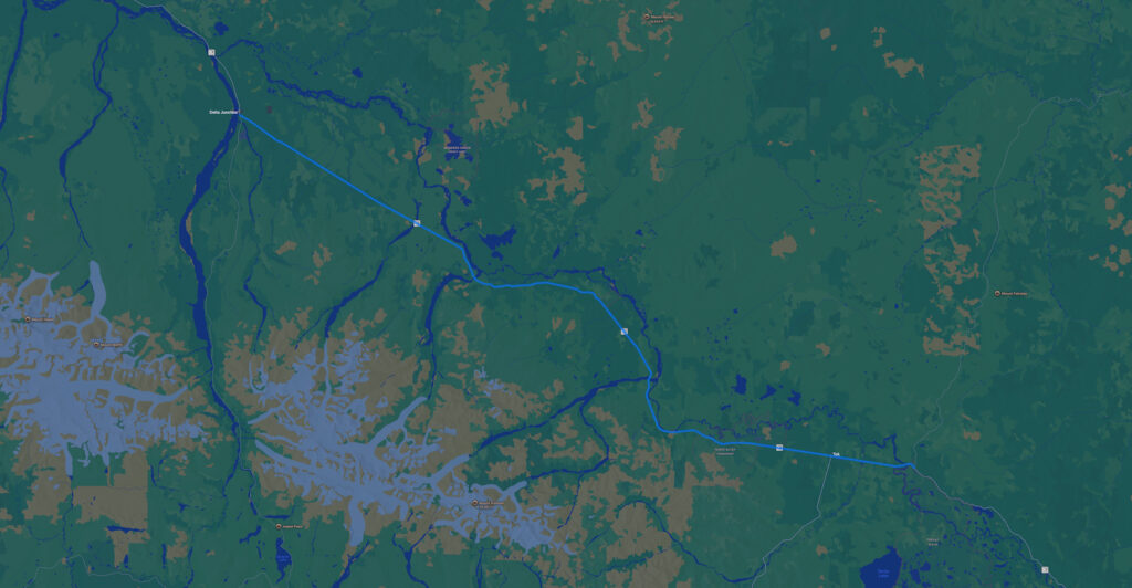
    Captured in July 2025 on the northernmost segment of the Alaska Highway AK-2 from Tetlin Junction near Tok to the terminus at Delta Junction where AK-2 becomes the Richardson Highway.

    View and download this route

    YouTube Full Videos

    YouTube Shorts

    Original music for this video:

    YouTube Playlists:

    My music is available for streaming and purchase at:

  • Mojave Preserve

    Mojave Preserve

    A drive through the Mojave National Preserve reveals the stark beauty and dramatic contrasts of the American desert. Sand dunes rise unexpectedly beside dark volcanic rock formations, while scattered Joshua trees stretch across broad valleys framed by distant mountain ranges. The road often feels endless, carrying travelers through quiet landscapes where the only movement may be a circling hawk or a freight train crossing the horizon. Despite the harsh climate, the preserve contains a surprising variety of life and color, especially in the softer light of morning and evening. The silence and isolation create a calm, reflective atmosphere, allowing the scenery to feel almost cinematic in its scale and emptiness. Every mile offers a reminder of how vast and untamed the desert can be.

    Captured in August 2025 on the path from Twentynine Palms to Baker, California. Primary roads include California SR 62, Amboy Road, briefly on Route 66, and following Kelbaker Road the rest of the way.

    View and download this route

    YouTube Full Videos

    YouTube Shorts

    Original music for this video:

    YouTube Playlists:

    My music is available for streaming and purchase at:

  • Yellowstone

    Yellowstone

    A summer drive from the Northeast Entrance into northern Yellowstone National Park reveals dramatic scenery from the very first mile. Steep rocky cliffs and rolling valleys stretch across the horizon as the road follows the Yellowstone River through open meadows filled with wildlife. Warm sunlight, cool mountain air, and the peaceful rhythm of the landscape make the journey feel both adventurous and serene.

    Captured in July 2024. The main roads of Yellowstone form a figure eight, and this journey starts from the north east corner coming in on US-212 toward Tower Junction, then moving south toward Canyon Village and over to West Yellowstone. The route then follows US-89 to the Roosevelt Arch at the North Entrance in Gardiner, MT. Proceeding then on the north side on Grand Loop Road toward Tower Junction again, and proceeding south to the Lake area, and following US-14 east toward Cody, WY. The extended version of this video shows the drive following the North Fork of the Shoshone River along the Buffalo Bill Cody Scenic Byway.

    View and download this route

    YouTube Full Videos

    YouTube Shorts

    Original music for this video:

    YouTube Playlists:

    My music is available for streaming and purchase at:

  • Mount Rainier

    Mount Rainier

    In summer, the road to Paradise in Mount Rainier National Park becomes a stunning passage through some of the Pacific Northwest’s most beautiful landscapes. Sunlight filters through tall pine forests before revealing rolling meadows alive with blooming flowers and panoramic views of icy glaciers high above. Scenic pullouts offer perfect moments to pause and admire the mountain’s immense presence, while the peaceful atmosphere and gentle mountain breeze make the drive feel both relaxing and awe-inspiring.

    Captured in August 2025 starting from Washington SR 123 in the Gifford Pinchot National Forest onto Stevens Canyon Road and looping back from Paradise.

    View and download this route

    YouTube Full Videos

        YouTube Shorts

        Original music for this video:

        YouTube Playlists:

        My music is available for streaming and purchase at:

      • Florida Big Bend II

        Florida Big Bend II

        The backroads of Florida’s Big Bend and Nature Coast offer a glimpse of a Florida that seems to have been left behind by time. Starting from Cedar Key, the narrow dirt roads stretch into a landscape where modern life feels distant, and the rhythms of nature take the lead. The winding routes, often shaded by dense groves of pines and ancient oaks, lead travelers deep into the Lower Suwannee National Wildlife Refuge, an expanse of coastal wilderness that has remained largely untouched. Here, the land is rugged and wild, with salt marshes and tidal creeks carving their way through the landscape. 

        You pass small, sleepy towns like Otter Creek, where time seems to move slower and the old wooden homes still stand with the same quiet dignity they’ve had for generations. Along the way, the air is thick with the scent of salt and pine, and the soft sound of the gulf can be heard in the distance. The gulf’s waters, calm and pristine, stretch endlessly, mirroring the feeling of isolation and peace that defines this area. 

        This is the Old Florida that many have forgotten, where nature reigns, and the roads lead to a simpler, more authentic way of life—one that feels like a world apart from the state’s more bustling, tourist-driven areas.

        Captured in October 2023, two months after the devastation brought to the area by Hurricane Idalia. The park at Shired Island, including the jetty (featured in my “before Idalia” video), was completely destroyed, along with the nearby road. In 2024, Hurricanes Debby and Helene caused further damage, and as of early 2026, the park is completely blocked off from normal vehicle access. More than half of the homes at Dark Island shown in this video were swept away by the immense storm surge of Hurricane Helene in 2024.

        Locations in this video include Cedar Key, Shell Mound, Manatee Springs, Suwannee, Shired Island, Horseshoe Beach, Steinhatchee, Hagens Cove, Dark Island, Keaton Beach, Deckle Beach, Adams Beach, and sunset at Dark Island.

        Note that this was captured with an older camera.

        View and download this route

        YouTube Full Videos

        YouTube Shorts

        Original music for this video:

        YouTube Playlists:

        My music is available for streaming and purchase at: